Getting to Likiep
The Marshall Islands that Scotty knew were “owned,” for the most part, by the United States. Take, for example, the Marshall Island known as Kwajalein. As the United States Army’s primary long-range missile testing facility, it’s usually off-limits to anyone not associated with the military. That exclusion includes even the Marshallese from whom that island is leased. [1] Those folks live on nearby Ebeye Island, a desolate strip prone to water shortages and diabetes [2]. And, while some of those folks can visit Kwajalein, it’s only because they have a security clearance for jobs on the base. And even then… their presence is closely monitored. As one local resident noted:
They won't even let the women leave the island with a Coke in their purse after working as a maid all day. We have to put up with them and can't even buy food from vending machines at the dock to take back to Ebeye (the nearby island where Marshallese reside). [3]
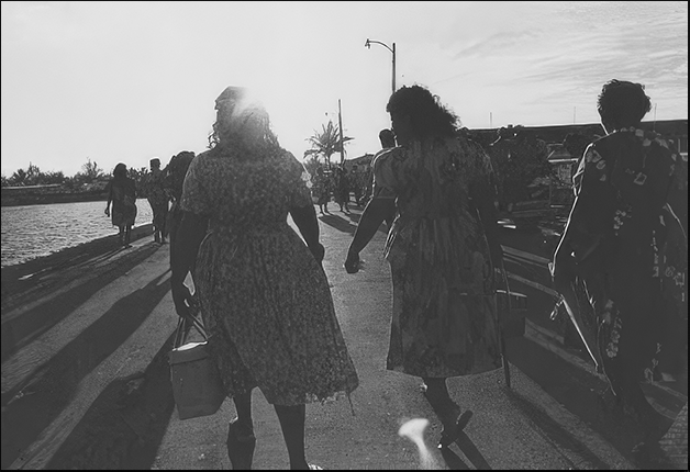
(Courtesy: Pacific Collection, University of Hawaii-Manoa)
But on a February day in 1978, something momentous happened. It was the grand opening of the brand new Marshallese Cultural Center. The locals — the Marshallese — still had some lingering questions. Why build it on Kwajalein instead of Ebeye, where the Marshallese people actually live? And why place it on an atoll whose lagoon serves as a firing range for U.S. missiles? It’s your history, your culture — but hasn’t it been hijacked? The only way to get there is a twenty-minute boat ride that, for most residents, is only made when they’re flying out to Majuro [4].
Where The Hell Is Majuro?
That’s not the only bad joke around here. A popular joke t-shirt on these island atolls reads: Where The Hell Is Majuro? Okay, so it’s a crossroads of cultures and histories in the North Pacific, two thousand or so miles from Hawaii. That’s one answer. But it’s more than that. As a Peace Corps volunteer once described it, Majuro is “an odd blend of Gauguin and K-mart… a place where you bounce from glory to squalor a dozen times a day, so often that you wonder if there isn’t a linkage between the two, some weird symbiosis between lagoons and diapers, sunsets and beer cans.” (P.F. Kluge, Looking Back, 1972).
Big But Very Small
To put it in measurable terms, the Republic of the Marshall Islands — as it is now known — “consists of approximately seventy square miles of land spread over 750,000 square miles of ocean… Over thirty-three thousand of the fifty thousand Marshall Islanders reside on less than five square miles of land, on just two of the total thirty-three coral atolls and islands that constitute the nation. These two sites are Majuro Atoll (3.75 square miles) and Ebeye Island (part of the Kwajalein Atoll @ .14 square miles).” [4]
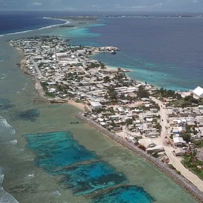
Heaven being the niceties on the Kwajalein Base
In fact, as Julianne Walsh — and others — write, it is difficult to imagine present day Majuro without its colonial influences. Including, of course, the United States, which is only the latest in a long line of semi-permanent visitors. And so it goes.
What we know of early history in the Marshalls, on the other hand, comes from an oral history which, according to local folklore, has it that the “first discoverers and settlers of the Islands were a handful of wayfarers seeking an uninhabited autonomous area where they could live.” [5 ] By 1526 — and the Age of Discovery — eight Spanish ships had passed through what is now the Marshalls. The Spanish influences are still seen here and in the Philippines, with wisps of Spanish still scattered through both languages.
New Kids in Town
Fifty years later, it was the Dutch who passed through, followed by the British, the Russians and the Germans. It was the Germans, sensing profitable trade possibilities, who turned nearby Likiep Atoll into a flourishing copra trade center in the 19th century. Who, indeed, introduced the trade to the Marshallese who preceded them. By 1885 the Marshall Islands became a protectorate of Germany. The Germans noted that, “the Marshall Islands were not under the sovereignty of any civilized [sic] state.” [6]. And then, with the defeat of Germany in World War I, the Marshalls passed… To the Japanese Empire. We know how that turned out.
A Japanese military presence in Micronesia began in 1914 when naval forces occupied The German administered Micronesian islands with British encouragement predicated by the Anglo-Japanese Alliance of 1902. Japan occupied all German islands north of the equator, while Britain planned to control all German islands south of the equator. [7]
The Company Atoll
But since it’s Likiep that concerns us here — we’re still looking for Scotty remember? — we’ll move to another atoll filled with history. And know this: to get there from Majuro one passes by Kwajalein (and Ebeye), the nearest places of any importance. They’re a mere 130 miles away from Majuro. BUT scheduled airline routes north to Likiep were iffy. Taking the Grumman Goose operated by Tradition Air Transport Service seemed the best option. The only “if” being whether or not they’d actually found the boy. He always seemed one jump ahead, didn’t he?
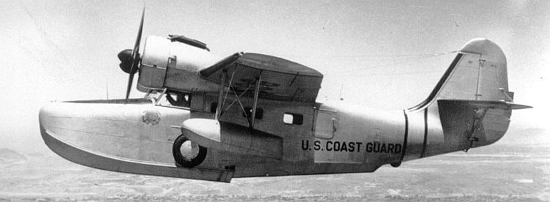
(Military version of seaplane serving Majuro; courtesy USCG)
Likiep, Germans & Copra
The European explorers were the first “outsiders” to venture into the Marshall Islands. Their mode of contact soon devolved into what was mostly confrontation. The whalers who followed the explorers were hunting to provide lamp oil; that pursuit led them to favor cheap “local” labor — and relations soon turned hostile. “Numerous ships were attacked by the Marshallese and their crews killed; brutal retaliations followed.” [8]
A more peaceful era followed as the copra trade took over, led by the German trading company Jaluit Gesellschaft. Their administration of the Marshalls was primarily economic, with little impact on the health and education of the Marshallese. Yes, the modern era is scarily similar. And with it come two entrepreneurs: Adolph Capelle and Jose deBrum. Together they established a trading company — A. Capelle & Co. — in 1864. By August 1877, Jose deBrum purchased the entire Likiep atoll from a local Marshallese for “merchandise valued at $1250.00.” [Note: Copra is the dried white flesh of a coconut, used mainly to extract coconut oil.]
Playing Dominoes
The dominoes started to fall into place. One year later, Germany entered into a treaty with locals, granting special trade privileges. Jose deBrum transferred his deed to Capelle & Co in return for $886.73. Subsequently an agreement was signed with the residents of Likiep allowing them to remain on the island. The stipulation: they agreed to work for Capelle at the fixed rate of $2.00 a month. “Likiep is to be the base from which Capelle & Co will conduct its future commercial venture throughout the area.” [9]. This is what it looked like at the very beginning:
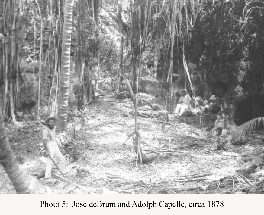
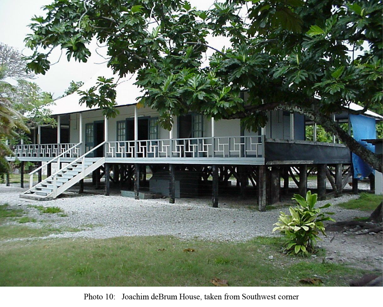
By 1901, Jose deBrum had died in Likiep. His son Jose son took over his share of the business. With the plantation and its economic might now felt throughout the Marshalls, Jose deBrum decided to build his own house, now referred to as the deBrum House. Below is what Likiep looked like in 1904. It is a pattern that seems to repeat itself.
(Courtesy Williamson & Stone)
REFERENCES
[1, 3] Imagining the Marshalls: Chiefs, Tradition and the State on the Fringes of U.S. Empire, Julianne M. Walsh, Ph. D. candidate, University of Hawai’i, Dept. of Anthropology, August 2003
[2, 4] Reuters, “They Help Preserve America’s Dominance in the Pacific,” McKenzie, Pete and Adams, Holly, December 2025
[5] Anthropological Survey of Likiep Atoll, Republic of the Marshall Islands Historic Preservation Office, Williamson and Stone, 2001
[6] ibid, Williamson and Stone
[7] ibid, Williamson and Stone
[8] ibid, Williamson and Stone
[9] ibid, Williamson and Stone
The Book: Kill Brother, Kill Sister
My latest book is available at Amazon, Barnes & Noble and other fine bookstores (paperback and ebook).
Copyright Leland E. Hale (2026)